no title
LA is a big city. But I was curious just how much bigger it was compared to my former home, Hamburg, Germany. Hamburg is typically European, with it’s high density of public transit and largely mixed-use zones. I walked and took the bus/train everywhere and only really biked for fun, rather than necessity.
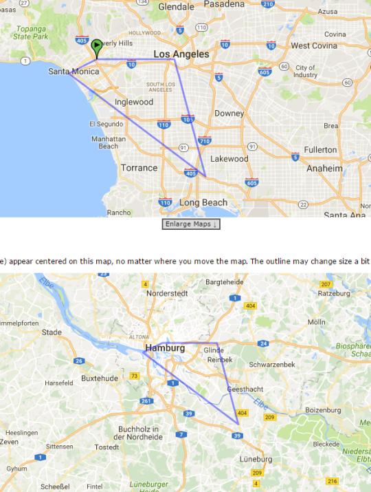
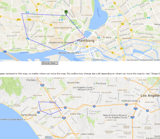
I used Mapfrappe to plot my old apartment in Hamburg (the green marker in the top image), downtown, St. Pauli, Altona and my work (clockwise vertices from the green marker). This pentagon contains the vast majority of where I would travel in the city.
Overlaying it on my neighborhood in LA shows just how small that is. I would and have walked those distances in LA, but wouldn’t think of doing that in Hamburg– it’s halfway across the entire city! There are ~5 train lines that cross that pentagon in Hamburg, but only one in LA. There are several very unique Hamburg neighborhoods in there, but in LA it’s just very similar suburbia. There are two breweries in that Hamburg pentagon, but none in LA’s counterpart.
Now to map LA over Hamburg. It kinda shows just how long my commute to Long Beach is (it’d be going to another state from my old home in Hamburg!).
I wish I knew more about city planning, so I could comment about how LA’s low density zoning has made distinct neighborhoods much larger and building a comprehensive rail system expensive.