Combined Biking and Transit Directions
My Carless-in-LA Experiment has been underway for a little over two months now. And I feel great! I’m biking into work, walking to places more, ordering groceries from Amazon Fresh. It’s surprisingly easy. As long as I never leave the westside.
Despite popular perception, public transit in LA is fairly comprehensive, as long as you start and end your trip along a single line. It gets slow when you have to walk ~10 mins at each end, and wait for one or more transfers. I don’t live far from the Metro but it still takes me an hour to get to the Metro-adjacent Arts District.
But I have a bike! I can use that to shorten the walking durations, or even replace a multi-legged route with something sans-transfers that otherwise would have required too much walking.
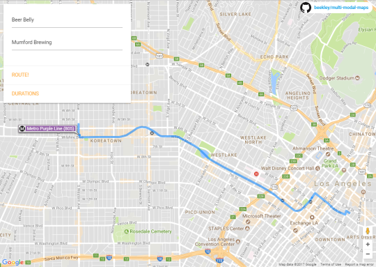
So I put together a quick app that uses the Google Maps APIs to provide directions that combine both biking and public transit. It also compares how long Google says it would take to do the same route solely via cycling, driving or public transit. Biking+Transit is often within a few minutes of driving, or even faster at times with traffic.
You can play around with a demo here. Source is on Github.